Blog
5 Killer 3D Map Apps for iPhone
Paper maps are still around and useful for those who spend a lot of time visiting new areas and going on adventures. Paper maps can be life savers in some situations, but they have their limitations too. For starters, you can’t really interact with paper maps. Besides, you can’t buy 3D paper maps. That’s where your iPhone comes into play. There are plenty of 3D map apps available for iPhone that can help you explore your surroundings more effectively and find your way around using your phone without too much fuss.
If you intend to go through 3D maps on your iPhone, these 5 applications are must try:
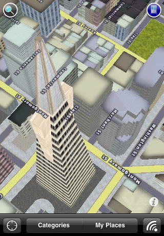
UpNext 3D Cities: while it does not cover all cities, it does have super maps of cities that does cover. The maps are high quality and make it much easier to find things in your city on iPhone.
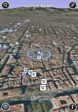
Google Earth: Google Earth does not need any introduction. It’s one of the best apps around to explore our Earth and your city. Perhaps the best app to explore cities with.
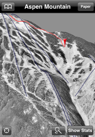
iTrailMap 3D: a handy app for hikers and climbers (and for ski) that shows you 3D mountains along all kinds of useful information about your location. 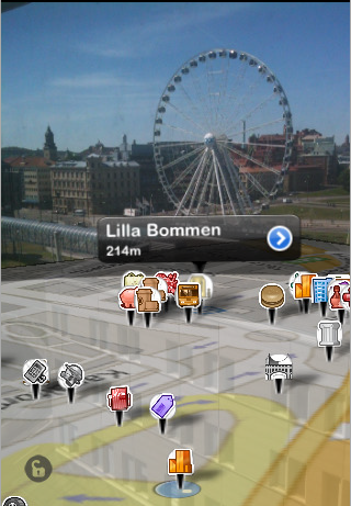
WallaBy 3D: an augmented reality application that displays nearby spots on your phone. You can use it to find and check in Gowalla locations.
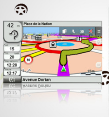
TwoNav for iPhone: transforms your iPhone into an outdoor GPS device. It can be enhanced to show you 3D maps on the go. It has topographic maps of USA and Canada.
Any suggestions?
Similar apps
- Paris 3D
- Living Earth for iPhone
- Citymapper Live Transit App
- Pocket Earth PRO for iPhone & iPad
- Earth-Now